
Roslyn Street names and numbers to 1950
 Click on map to toggle between map versions.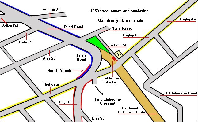
Sketch map copyright Alan Gilchrist 2007
Blue lines indicate where street numbering starts for Taieri Road at this time.
Red lines indicate City Road and where the street numbers change to Highgate ones.
Yellow lines indicate Highgate numbering.
1951 Note: - Stones Directory shows the LHS of City Road continuing across Highgate to just past the Roslyn Motors Garage site.
Some time prior to 1919 City Road was in fact part of Taieri Road, starting at Sligo Terrace - Scarba Street junction. Also, prior to 1919 Highgate was known as High Street. See also 1952 photograph of road works below Highgate, and ripping up the rails - after the demise of the Kaikorai line cable cars.