
Roslyn Street names and numbers to 2002
 Click on map to toggle between map versions.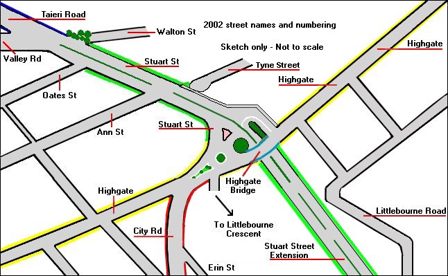
Sketch map copyright Alan Gilchrist 2007
Blue lines indicate where street numbering starts for Taieri Road at this time.
Red lines indicate City Road and where the street numbers change to Highgate ones.
Yellow lines indicate Highgate numbering.
Green lines indicate Stuart Street Extension.
After the Stuart Street Extension was completed, the ends of both Walton and Ann Streets were made no entry or exit, and Oates Street is now entry only (from memory).
See also Before & After photographs of the bridge area.